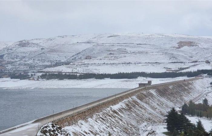
The eastern Mediterranean basin is affected by cold air masses, and colder masses, accompanied by heavy rain and snow, dominate at low levels that touch 600 meters, especially in the north and south of the country, and their effect extends until the end of the week.The Lebanon Weather Forecast page on its Facebook page indicated that the mountains are on a date with heavy snowfall, and what distinguishes the storm “Yasmine” as the page called it is the center of the depression suitable for all parts of the country and the high humidity, which will lead to the accumulation of snow heavily relative to the medium heights (1000 m). .
In details:
At dawn today, Wednesday, a humid polar depression begins on Lebanon, accompanied by heavy rain and thunderstorms, and will continue at least until Thursday noon.
Snow begins to fall above 1100-1000 m, and gradually decreases between noon and afternoon hours, until 900-1000 m, and the Bekaa Valley in the early evening hours.
Around midnight on Wednesday – Thursday, the coldest and humid front enters, and with it the level of snowfall and accumulation of snow decreases to reach 700 m.
Of course, some snow falls below 700 m (i.e. between 500 and 600 m), but it is temporary.
The winds are moderate to brisk and the snow will remain in the mountainous areas, so please be careful while driving.
The accumulations are very good, and they are about 25-30 cm on the mountains of 1000 m and in the Bekaa, 50-60 cm on the mountains of 1500 m and 100 cm on the 2000 m.
The attached map is from the Meteociel website, showing the direct polar descent over Lebanon and the region, which will lead to the snow storm that will intensify between midnight Wednesday – Thursday and Thursday morning.
Weather for the coming days
As for the weather of the coming days, today, Wednesday, it will be cloudy with a gradual and noticeable decrease in temperatures, and scattered rain that will become more intense and be accompanied by thunderstorms and strong winds that raise the sea waves to about 4 metres. Snow falls during the day at a height of 900 meters, and the level of snow falls at night to reach 600 meters and below that at dawn on Thursday. We warn against taking mountain roads, especially Dahr El Baidar Road.
Thursday: Cloudy with temperatures below their seasonal average, and a wave of frost. Scattered rain and snow fall at a height of 600 meters and above, with some breaks during the day. Snow forms on the heights during the night and in the early morning hours, starting from 700 meters, so we warn of the danger of slipping.
Friday: Partly cloudy to cloudy with no temperature adjustment, scattered rain with lightning and thunder. Snow falls at an altitude of 700 meters and above, and ice forms on mountain roads above 800 meters during the night.
These were the details of the news Storm ‘Yasmine’ has begun… and will reach its climax on this... for this day. We hope that we have succeeded by giving you the full details and information. To follow all our news, you can subscribe to the alerts system or to one of our different systems to provide you with all that is new.
It is also worth noting that the original news has been published and is available at saudi24news and the editorial team at AlKhaleej Today has confirmed it and it has been modified, and it may have been completely transferred or quoted from it and you can read and follow this news from its main source.

